
|
|
|


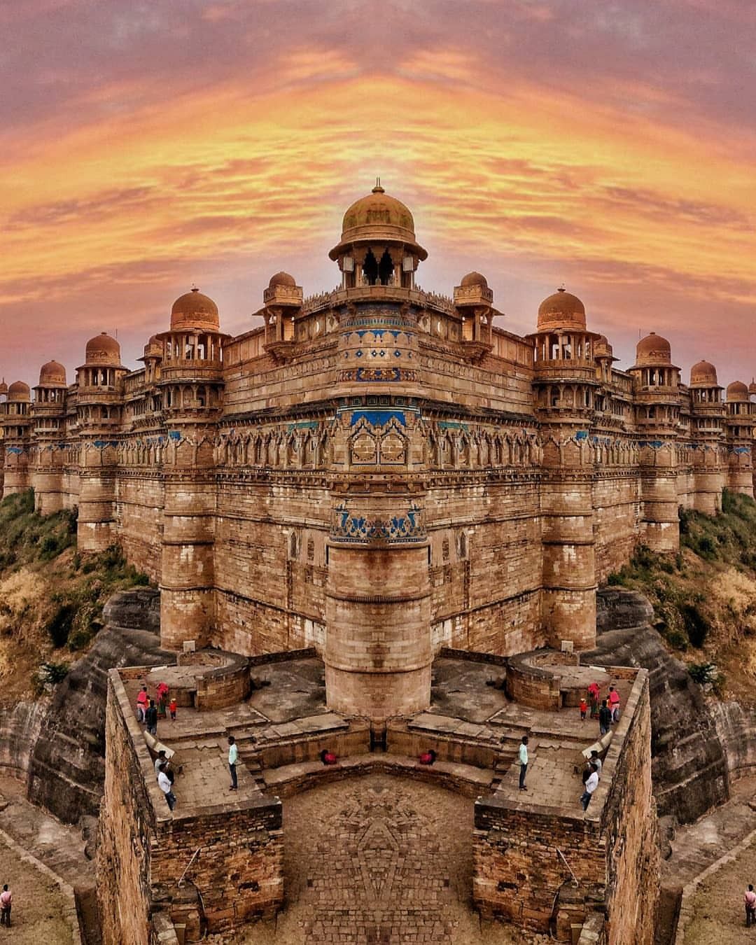
Gwalior district is a district of the Indian state of Madhya Pradesh. This district is under the revenue division of Gwalior. This district is situated between 25 0 34 ‘north and 260’ 21 north latitude and 770 40 ‘east and 780 54’ in the northern part of Gwalior state. This district is spread over a 2002 square meter area, which is 1.1 percent of the total area of Madhya Pradesh state. Gwalior was the capital of central India from 1948 to 1956 but when the central India was connected to Madhya Pradesh, it was given the form of the district. This district was named after a famous fort. The name of this famous fort was taken from the name of Pahadi. This flat summit was called Gopachal, Gopgiri, Gop Mountain or Gopadri. This has created the word Gwalior. Gwalior’s history is traced back to a legend in 8th century AD when a chief tain known as Suraj Sen was struck by a deadly disease and cured by a hermit-saint Gwalipa. As a gratitude for that incidence, he founded this city by his name. The new city of Gwalior became existance over the centuries. The cradle of great dynasties ruled the city Gwalior. With different Dynasty, the city gained a new dimension from the warrior kings, poets, musicians, and saints who contributed to making it renowned throughout the country. The city is also the setting for the memorials of freedom fighters such as Tatya Tope and the indomitable Rani of Jhansi.

At a distance of 20 km from Gwalior, Tighra Dam or Tigra Dam is a fresh water reservoir situated at Tighra near Gwalior in Madhya Pradesh. It is the primary source of drinking water to the city of Gwalior and also one of the popular picnic places to visit near Gwalior. Tighra Dam was constructed in 1916 on the Sank River and is a major source of water for the city of Gwalior. This dam has been constructed in the vicinity of eleven villages.
The park is situated near Shivpuri town and is a part of the upper Vindhyan hills. The Park was the hunting ground of Mughal emperors and Maharaja of Gwalior. It got the status of a National Park in 1958. There are two entry points for the park; one situated on NH-25 (Old Jhansi road) about 5 km from Shivpuri town while the other is on NH-3 (Agra-Mumbai road) at a distance of 7 km from Shivpuri towards Gwalior.
The Gwalior
airport is one of the four major airports in the region, which is also the Indian
Air Force Base. All the major airlines have flights to Gwalior from the different
part of India.
Nearest Airport: Agra Airport (AGR) - 107 kms from Gwalior
Gwalior is situated on the North-South corridor of the National Highway. NH3, NH75 and NH92 connect Gwalior to the major cities in the country. You can hire a taxi from New Delhi or travel in the buses that ply from the nearby cities to Gwalior.
Gwalior is connected to all the major cities across India by regular trains. You can easily find autorickshaws and taxis outside the railway station to travel to any part of the city.
Gwalior has a highly efficient public transport system and travelling within the city can be easily facilitated by buses and auto-rickshaws. Tourists can also hail cabs to cover all sightseeing spots together comfortably.
| Month | High/Low (°C) | Rain |
|---|---|---|
| January | 21°/ 9° | 3 days |
| February | 27°/ 11° | 1 days |
| March | 31°/ 17° | 1 days |
| April | 37°/ 22° | 2 days |
| May | 42°/ 27° | 1 days |
| June | 41°/ 29° | 4 days |
| July | 35°/ 27° | 17 days |
| August | 32°/ 25° | 23 days |
| September | 31°/ 24° | 23 days |
| October | 32°/ 21° | 3 days |
| November | 30°/ 18° | 2 days |
| December | 21°/ 9° | 1 days |
The best time to visit Gwalior is from October to March . However, those who don't mind little rains can also visit between July and September. The four-day Tansen Music Festival (Nov/Dec) is also a good time to visit Gwalior if you are interested in enjoying the Indian classical music performances.